150 AMESBURY DRIVE
Owner Information
HEWITTS COVE MARINA LLC
24 SHIPYARD DRIVE
HINGHAM, MA 02043


Property Details
150 AMESBURY DRIVE is classified as a Developable Commercial Land (Vacant land).
150 AMESBURY DRIVE is valued at $1,420,900. The land is valued at $1,420,900 and the structures are valued at $0.
This property is in Zone XX. Confirm with local Zoning Board authorities to ensure there are no overlays or other easements on this property.
The most recent deed for 150 AMESBURY DRIVE is recorded at the local registrar in Book 29868, Page 0302. 150 AMESBURY DRIVE was last sold on Thursday, January 20, 2005 for $1.
Assessment data from fiscal year 2022.
Flood Data
According to the FEMA National Flood Hazard Layer, this property does not appear to be in a flood zone. It may also be in an area not yet reviewed. Nonetheless, confirm this information prior to taking any action.
To view the flood hazards around this property, create a FEMA "Firmette" Map of the area around 150 AMESBURY DRIVE.
Broadband Internet Providers
| Provider | Type | Bandwidth (mbps) | |
|---|---|---|---|
| Viasat Inc | Satellite | 100 | 3 |
| Verizon New England Inc. | DSL | 1 | 0 |
| Comcast | Cable | 1000 | 35 |
| Verizon New England Inc. | Fiber | 940 | 880 |
| GCI Communication Corp. | Satellite | 0 | 0 |
| HughesNet | Satellite | 25 | 3 |
| VSAT Systems, LLC. | Satellite | 2 | 1 |
Broadband service provider data from December 2020.
Adjacent Properties
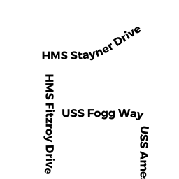
- 102 STAYNER DRIVE
Residential Condominium owned by BRAMSON CAROL E TT - 115 STAYNER DRIVE
Residential Condominium owned by VOGEL DAVID A & DEBORAH R TT - 116 STAYNER DRIVE
Residential Condominium owned by HANLEY ADRIANNE - 117 STAYNER DRIVE
Residential Condominium owned by CAHILL JAMES J & CAHILL MARY C TT - 118 STAYNER DRIVE
Residential Condominium owned by DELANEY NEIL - 119 STAYNER DRIVE
Residential Condominium owned by QUIGLEY RICHARD & PATRICIA L (LE) - 120 STAYNER DRIVE
Residential Condominium owned by KARAN STEVEN A TT - 121 STAYNER DRIVE
Residential Condominium owned by DECRISTOFARO DEBORAH L - 122 STAYNER DRIVE
Residential Condominium owned by NAPPI MICHAEL D & LAUREN N - 123 STAYNER DRIVE
Residential Condominium owned by HARDIMAN JUDITH A & ROBERT J - 124 STAYNER DRIVE
Residential Condominium owned by HENKE KRIS & RANDY - 125 STAYNER DRIVE
Residential Condominium owned by OLAUGHLIN DAVID W & MARIA A - 127 STAYNER DRIVE
Residential Condominium owned by DRISCOLL THOMAS F JR & DONNA JEAN - 128 STAYNER DRIVE
Residential Condominium owned by MCNELIS BRANDON & STEELE HALEY - 129 STAYNER DRIVE
Residential Condominium owned by PAPILE ELOISE A - 130 STAYNER DRIVE
Residential Condominium owned by RYAN MICHAEL - 131 STAYNER DRIVE
Residential Condominium owned by BOYMEL DAVID - 132 STAYNER DRIVE
Residential Condominium owned by REARDON JOHN & SUZANNE - 133 STAYNER DRIVE
Residential Condominium owned by HAMROCK JAMES S JR & MARIAN - 134 STAYNER DRIVE
Residential Condominium owned by ORLANDO RICHARD A & ORLANDO LINDA P TT - 135 STAYNER DRIVE
Residential Condominium owned by LEBLANC PAUL & KATHLEEN - 136 STAYNER DRIVE
Residential Condominium owned by SCHMIDT SONDRA TT - 137 STAYNER DRIVE
Residential Condominium owned by BERKELEY WILLIAM F & KELLY G - 138 STAYNER DRIVE
Residential Condominium owned by DISANO HENRY M - 139 STAYNER DRIVE
Residential Condominium owned by CAMPBELL CHRISTOPHER - 141 STAYNER DRIVE
Residential Condominium owned by DOBROWSKI JOHN M & MARY A - 143 STAYNER DRIVE
Residential Condominium owned by VENTRESCO JOSEPH & JENNIFER - 147 STAYNER DRIVE
Residential Condominium owned by HOIBERG LES L & MICHAEL - 149 STAYNER DRIVE
Residential Condominium owned by HANLON SARAH C TT - 151 STAYNER DRIVE
Residential Condominium owned by JACOBSEN JAMES E & JUNE B - 153 STAYNER DRIVE
Residential Condominium owned by CIFRINO FRANCES R - 155 STAYNER DRIVE
Residential Condominium owned by CROCKETT FREDERICK & MICHELLE - 156 STAYNER DRIVE
Residential Condominium owned by CRENIER PETER & LINDA - 157 STAYNER DRIVE
Residential Condominium owned by MICHAELSON JEFFREY & MARCHIONI SUSAN - 158 STAYNER DRIVE
Residential Condominium owned by JONES ELYSE & RUIZ DEVIN - 159 STAYNER DRIVE
Residential Condominium owned by MATHIEN JENNIFER & TIMOTHY R TT - 160 STAYNER DRIVE
Residential Condominium owned by MANDEVILLE JUDITH A TT & MANDEVILLE PAUL J TT - 161 STAYNER DRIVE
Residential Condominium owned by SHERMAN JOHN F III & ANDREA R - 162 STAYNER DRIVE
Residential Condominium owned by LEMAY MATTHEW & SARAH - 163 STAYNER DRIVE
Residential Condominium owned by FITZGERALD JOSEPH E & JILL JOANNE - 164 STAYNER DRIVE
Residential Condominium owned by HERRICK STEPHEN J TT - 165 STAYNER DRIVE
Residential Condominium owned by YAMARTINO STEPHEN & CAROL - 166 STAYNER DRIVE
Residential Condominium owned by RENSTROM BRAIN & MARY - 167 STAYNER DRIVE
Residential Condominium owned by SCHNEIDER RICHARD E & LEA A - 168 STAYNER DRIVE
Residential Condominium owned by SULLIVAN LEO J & SULLIVAN NANCY A TT - 170 STAYNER DRIVE
Residential Condominium owned by SALVUCCI DEBRA - 171 STAYNER DRIVE
Residential Condominium owned by STOGNER SAMUEL & KATIE - 172 STAYNER DRIVE
Residential Condominium owned by WANG YANPING & LI LIJUN - 173 STAYNER DRIVE
Residential Condominium owned by CURTIS DIANNE - 174 STAYNER DRIVE
Residential Condominium owned by KOVAC JOHN R TT - 175 STAYNER DRIVE
Residential Condominium owned by ROOT CATHERINE A TT - 177 STAYNER DRIVE
Residential Condominium owned by SMITH TIMOTHY & MARY-DIXON - 179 STAYNER DRIVE
Residential Condominium owned by GUERLAND DAVID ARMAND & NANCY LOUISE - 101 HALSTED DRIVE
Residential Condominium owned by BARRETT PATRICK & JOAN - 103 HALSTED DRIVE
Residential Condominium owned by STAHR JOHN & JENNIFER - 105 HALSTED DRIVE
Residential Condominium owned by AUSTIN MAUREEN F & ALBERT A JR - 107 HALSTED DRIVE
Residential Condominium owned by LANNA OLIVIA - 109 HALSTED DRIVE
Residential Condominium owned by ANTONE LEWIS E JR & LAURIE P - 111 HALSTED DRIVE
Residential Condominium owned by MACINNIS lll GEORGE & PANUSCHKA TRACY - 113 HALSTED DRIVE
Residential Condominium owned by IMER ORHAN & MARCIA - 115 HALSTED DRIVE
Residential Condominium owned by HOSP RICHARD DAVID - 117 HALSTED DRIVE
Residential Condominium owned by CHRISTMAN LINDA M & JOSEPH - 119 HALSTED DRIVE
Residential Condominium owned by DOVE CATHY S - 123 HALSTED DRIVE
Residential Condominium owned by LOH LAWRENCE & BARBARA - 125 HALSTED DRIVE
Residential Condominium owned by MCMURTRIE MARGARET M - 127 HALSTED DRIVE
Residential Condominium owned by STARR STEVEN F & NANCY H TT - 129 HALSTED DRIVE
Residential Condominium owned by CASEY THOMAS & ELIZABETH - 131 HALSTED DRIVE
Residential Condominium owned by QUINN MAUREEN & BURKE MARIA - 133 HALSTED DRIVE
Residential Condominium owned by STEVENSON SCOTT R & ALEXSANDRA K - 135 HALSTED DRIVE
Residential Condominium owned by HURLEY WILLIAM T III & SUZANNE S TT - 137 HALSTED DRIVE
Residential Condominium owned by FLEMING THERESE M TT - 139 HALSTED DRIVE
Residential Condominium owned by ZIZIC KRISTINE & ZIZIC LARA TT - 140 HALSTED DRIVE
Residential Condominium owned by DIMKE ROBERT J JR & PATRICIA A TT - 141 HALSTED DRIVE
Residential Condominium owned by MULLON CLAUDY & JENNIFER PATRICE TT - 142 HALSTED DRIVE
Residential Condominium owned by SMERIGLIO ANTHONY P & EILEEN T TT - 143 HALSTED DRIVE
Residential Condominium owned by PICKRELL JOHN J JR & DELRIO SAMUEL - 144 HALSTED DRIVE
Residential Condominium owned by NOLL KAREN - 145 HALSTED DRIVE
Residential Condominium owned by SADLER FRANCESCA TT - 149 HALSTED DRIVE
Residential Condominium owned by KENNEDY MICHAEL J & MARY E - 151 HALSTED DRIVE
Residential Condominium owned by WAITE PHILIP & CAROLE A TT - 153 HALSTED DRIVE
Residential Condominium owned by GARLAND SUZANNE M TT - 155 HALSTED DRIVE
Residential Condominium owned by MAROTTA JAMES & VERSACE-MAROTTA DENISE - 157 HALSTED DRIVE
Residential Condominium owned by SNYDER RICHARD & GOODMAN SHERRYL H - 159 HALSTED DRIVE
Residential Condominium owned by ABETH REALTY CO., INC - 161 HALSTED DRIVE
Residential Condominium owned by TAUBERT FREDERICK W & MAUREEN M - 163 HALSTED DRIVE
Residential Condominium owned by PARSONS JEFFREY R & MARGARET - 165 HALSTED DRIVE
Residential Condominium owned by REALE JOSEPH A & KAREN J TT - 167 HALSTED DRIVE
Residential Condominium owned by HAWLEY E ROBERT & HAWLEY VICTORIA T TT - 169 HALSTED DRIVE
Residential Condominium owned by HURLEY MARY E TT - 171 HALSTED DRIVE
Residential Condominium owned by FULL HOUSE REALTY TRUST - 175 HALSTED DRIVE
Residential Condominium owned by RYAN ELIZABETH - 177 HALSTED DRIVE
Residential Condominium owned by COOMBE GARY & HEIDI - 178 HALSTED DRIVE
Residential Condominium owned by CHANG CHING HAW & HUI CHUAN TT - 179 HALSTED DRIVE
Residential Condominium owned by POMAROLE JOHN M & JACKIE E TT - 180 HALSTED DRIVE
Residential Condominium owned by REEVES MARGARET C TT - 181 HALSTED DRIVE
Residential Condominium owned by HORNSTRA PETER E TT - 182 HALSTED DRIVE
Residential Condominium owned by DOLAN DANIEL N & DAWN - 183 HALSTED DRIVE
Residential Condominium owned by MACKINNON DONALD J TT - 184 HALSTED DRIVE
Residential Condominium owned by FLYNN PATRICIA A - 186 HALSTED DRIVE
Residential Condominium owned by NOBLE THOMAS W JR & ROSEMARY E TT - 187 HALSTED DRIVE
Residential Condominium owned by MCGRATH WILLIAM TOD & MAUREEN J - 188 HALSTED DRIVE
Residential Condominium owned by CHANG HOWARD H & CHANG JOANNA Y TT - 190 HALSTED DRIVE
Residential Condominium owned by GILSON MATTHEW R & MARY M - 192 HALSTED DRIVE
Residential Condominium owned by SHORE STEPHEN J - 194 HALSTED DRIVE
Residential Condominium owned by PARNELL JOHN & SUSAN - 196 HALSTED DRIVE
Residential Condominium owned by ISER MARTIN TT - 198 HALSTED DRIVE
Residential Condominium owned by CROWLEY SEAN & CAROLYN - 101 AMESBURY DRIVE
Residential Condominium owned by POTTER GLEN H & MICHELLE L - 103 BUCKLEY PLACE
Residential Condominium owned by BLICKMAN JOHAN G - 103 AMESBURY DRIVE
Residential Condominium owned by MOYER ROBIN E TT - 105 AMESBURY DRIVE
Residential Condominium owned by MELEKHOV VALERI & ELENA - 107 AMESBURY DRIVE
Residential Condominium owned by MARTUZA VICTOR R & COLEMAN ELAINE B - 101 BUCKLEY PLACE
Residential Condominium owned by GAO XIANG & TRAN ANH QUYNH - 102 BUCKLEY PLACE
Residential Condominium owned by ANKNER JOAN - 104 BUCKLEY PLACE
Residential Condominium owned by PIERCE JOHN M - 105 BUCKLEY PLACE
Residential Condominium owned by CORIATY MARK J - 106 BUCKLEY PLACE
Residential Condominium owned by FREEMAN JANE R TT - 107 BUCKLEY PLACE
Residential Condominium owned by GANZFRIED JERROLD J & SALLY C TT - 108 BUCKLEY PLACE
Residential Condominium owned by FERGERSON RANADA - 109 BUCKLEY PLACE
Residential Condominium owned by PAVLOV IGOR V & PAVLOVA NATALIA M - SHIPYARD
Other, Open Space owned by LENNAR HINGHAM HOLDINGS LLC - 130 WHITAKER LANE
Residential Condominium owned by TORRACO MARY F & ROBERT J - 132 WHITAKER LANE
Residential Condominium owned by DRISCOLL JOHN C & JEAN ANN - 133 WHITAKER LANE
Residential Condominium owned by CAROLAN KATHLEEN M TT - 134 WHITAKER LANE
Residential Condominium owned by CARTER DEBORAH M - 135 WHITAKER LANE
Residential Condominium owned by VOLKERT FAMILY TRUST THE - 136 WHITAKER LANE
Residential Condominium owned by HARE DEAN & LINDSEY - 137 WHITAKER LANE
Residential Condominium owned by DEAN CHARLES H III & COLLEEN L - 138 WHITAKER LANE
Residential Condominium owned by VENTRESCO SANDRA J - 139 WHITAKER LANE
Residential Condominium owned by WULF RICHARD A & CHRISTINE S TT - 101 STAYNER DRIVE
Residential Condominium owned by KENNEDY KATHARINE TT - 103 STAYNER DRIVE
Residential Condominium owned by MASONE ROBERT A - 104 STAYNER DRIVE
Residential Condominium owned by WILSON COLLEEN ERIN - 105 STAYNER DRIVE
Residential Condominium owned by CESARIO KIMBERLY - 107 STAYNER DRIVE
Residential Condominium owned by DUNN ALAN R & MAIMUNATON R - 108 STAYNER DRIVE
Residential Condominium owned by SIMON GREGORY & MARIA - 109 STAYNER DRIVE
Residential Condominium owned by THOMPSON DOUGLAS & LYNN - 110 STAYNER DRIVE
Residential Condominium owned by BEAUSEJOUR BRUCE P & JUDITH A - 111 STAYNER DRIVE
Residential Condominium owned by HAMMOND MARGOT MENDELSON & MICHAEL - 112 STAYNER DRIVE
Residential Condominium owned by BASTIA SAMBIT TT - 114 STAYNER DRIVE
Residential Condominium owned by FARMER BRENT H JR - 145 STAYNER DRIVE
Residential Condominium owned by SHUM TISHA Y - 169 STAYNER DRIVE
Residential Condominium owned by SHAUGHNESSY THOMAS A & MARISA - 121 HALSTED DRIVE
Residential Condominium owned by TANCREDI DEBORAH M & DAVID N TT - 110 BUCKLEY PLACE
Residential Condominium owned by TEED GLENN A & TEED DIANE Z - 147 HALSTED DRIVE
Residential Condominium owned by OLIVEIRA MARIO & REGINA - 173 HALSTED DRIVE
Residential Condominium owned by CARLSON RICK A & JAYE M - 185 HALSTED DRIVE
Residential Condominium owned by ROZENDAAL MICHELLE TT - 126 STAYNER DRIVE
Residential Condominium owned by SCHMIDT WAYNE ROBERT & SONDRA - 131 WHITAKER LANE
Residential Condominium owned by DROHAN D H TT DAVID H DROHAN 2020 TRUST - 106 STAYNER DRIVE
Residential Condominium owned by BARZOWSKAS MATTHEW DANIEL & BETHANY FONDA - 152 SHIPYARD DRIVE
Apt Over 8 owned by AVALON SHIPYARD LLC - 319 LINCOLN STREET
Apt Over 8 owned by HINGHAM SHIPYARD AVALON 2 INC. - 3 BIRCH CIRCLE
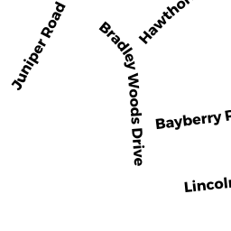
Single Family Residential owned by DOYLE COURTNEY S & JOHN J - 2 BRADLEY WOODS DR
Single Family Residential owned by NGUYEN HANH M - 12 JUNIPER ROAD
Single Family Residential owned by DOCKREY JOHN T & EDITH A - 9 JUNIPER ROAD
Single Family Residential owned by ATWOOD JUSTIN & EFFLER SUSAN